Table of Contents
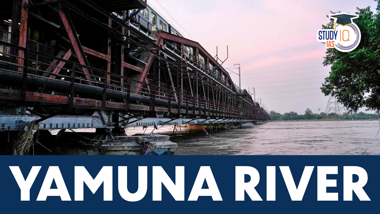
Toxic foam was seen floating on the surface of the Yamuna River in Delhi amid alarming air pollution levels in the city. The Yamuna River, which flows through the Indian capital of Delhi, has been plagued by the issue of toxic foam for many years. This foam is caused by a combination of factors, including the discharge of untreated sewage and industrial effluents into the river. The foam contains high levels of pollutants, including ammonia, phosphates, and heavy metals.

Image Credit: Outlook India
Yamuna River
There are several small and large Rivers of India making the Indian River System. The Ganga River System, Indus River System, Brahmaputra River System, Godavari, Krishna, Narmada, Tapi, and Mahanadi are the seven principal rivers that make up the Indian River System, together with numerous tributaries. One such river is the Yamuns River, which is a Tributary of Ganga River.
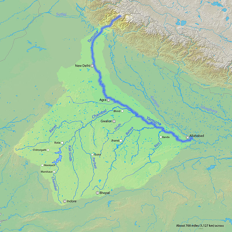
The Yamuna River is the longest river in India and one of the Ganges’ major tributaries by discharge. It begins at the Yamunotri Glacier, which is located in Uttarakhand at a height of about 4,500 m, on the southwest face of the Bandarpunch peaks of the Lower Himalayas. Its total length is 1,376 km, and its drainage system covers 366,223 km2, or 40.2% of the Ganges Basin. At Triveni Sangam, Allahabad, where the Kumbh Mela, a Hindu celebration conducted every 12 years, takes place, it unites with the Ganges.
We’re now on WhatsApp. Click to Join
About Yamuna River
In Hinduism, the Yamuna is worshipped as the goddess Yamuna, just as the Ganges. She is also known as Yami because she is the sister of Yama, the god of death, and the daughter of Surya, the solar god. Hindu mythology holds that swimming in the Yamuna’s holy waters can deliver a person from the afflictions of death. Check the table below for basic knowledge About the Yamuna River:
| About Yamuna River | |
| Particulars | Details |
| Flow in States | Uttarakhand, Himachal Pradesh, Uttar Pradesh, Haryana, Delhi |
| Important Cities on its Bank |
|
| Originates from | Yamunotri, Banderpooch Peaks, Uttarkashi district, Uttarakhand, India |
| Total Length | 1,376 km (855 mi) |
| Discharge in Ganga at | Pryagraj, Uttar Pradesh |
| Tributaries |
|
Yamuna River Origin and Features
- North of Haridwar in the Uttarkashi district of Uttarakhand, the Yamuna River’s source is located in the Yamunotri Glacier at an elevation of 6,387 meters (20,955 feet), on the southwest slopes of the Banderpooch peaks, which are part of the Mussoorie range of the Lower Himalayas.
- One of the holiest Hindu sites, Yamunotri Temple honors the goddess Yamuna and is a stop on the Chota Char Dham Yatra route.
- In close proximity to the temple is Markendeya Tirtha, where the sage Markandeya penned the Markandeya Purana. The 13-kilometer (8-mile) hike route follows the right bank of the river.
- The river flows through multiple states, including Uttarakhand, Himachal Pradesh, Uttar Pradesh, Haryana, Delhi. Along the route, it also encounters a number of tributaries, including Tons, Chambal, which is its longest tributary and has its own sizable basin, Sindh, the Betwa, and Ken.
- The river enters the state of Himachal Pradesh from Uttarakhand. The Yamuna travels past Paonta Sahib, along the border between Haryana and Uttar Pradesh, and after leaving Haryana, it keeps flowing till it joins the Ganges at Sangam or Prayag in Allahabad (Uttar Pradesh). Between it and the Ganges in the Indo-Gangetic plain, it contributes to the formation of the extremely fertile alluvial Ganges-Yamuna Doab region.
Catchment Area of Yamuna River
The Yamuna defines the state borders between Himachal Pradesh and Uttarakhand and between Haryana, Delhi and Uttar Pradesh. The Ganges-Yamuna Doab region is formed when the Yamuna and Ganges rivers meet in the Indo-Gangetic plain, running nearly parallel to one another. The area, which covers 69,000 square kilometres and makes up 1/3 of the alluvial plain, is well renowned for its agricultural output, especially for the production of basmati rice. The agriculture in the plain sustains
|
Catchment Area of Yamuna River |
||
| Extent of Yamuna River Catchment Area | Catchment Area (km2) | Catchment area in Percentage |
| Uttar Pradesh and Uttarakhand | 74,208 | 21.5 |
| Himachal Pradesh | 5,799 | 1.6 |
| Haryana | 21,265 | 6.5 |
| Rajasthan | 102,883 | 29.8 |
| Madhya Pradesh | 140,230 | 40.6 |
| Delhi | 1,485 | 0.4 |
The Yamuna then travels through the states of Delhi, Haryana, and Uttar Pradesh before joining the Ganges at the Triveni Sangam in Allahabad, a revered location. Boats ferry pilgrims to platforms built in the middle of the river where they can pray. Large crowds of people immerse themselves in the confluence’s holy waters during the Kumbh Mela, which is celebrated every 12 years.
On its banks are the cities of Allahabad, Baghpat, Delhi, Noida, Mathura, Agra, Firozabad, Etawah, Kalpi, and Hamirpur. At Etawah, it connects with another significant tributary, Chambal, and then a number of additional tributaries, including Sindh, the Betwa, and Ken, farther down.
Tributaries of Yamuna River
As the total length of the Yamuna River is 1,376 km with 69,000 sq km catchment year have been crafted by Yamuna River along with its tributaries. The important tributaries have been discussed below:

Tons River
The Tons River, which originates in the 6,315-meter-high (20,719-foot) Bandarpoonch mountain and has a sizable basin in Himachal Pradesh, is the greatest tributary of the Yamuna. Near Dehradun, Uttarakhand, it merges with the Yamuna below Kalsi.
Hindon River
Upper Shivalik in the Lesser Himalayan Range is the source of the Hindon River, which rises in the Saharanpur District. It travels 400 kilometres (250 miles) through Muzaffarnagar District, Meerut District, Baghpat District, Ghaziabad, Noida, and Greater Noida before joining Yamuna just outside of Delhi. It is fully rainfed and has a catchment area of 7,083 square kilometres (2,735 square miles).
Sabi River
A significant tributary of the Yamuna that drains into Delhi shortly before the Signature Bridge and continues on to the Wazirabad Barrage is the Sabi River, an ephemeral rain-fed river that is described in the Vedas. Its sources are in the Aravali range near Saiwar, and it travels a total of about 300 kilometres before entering Rajasthan, Haryana, and Delhi. Numerous wetlands along its path, including Chuchakwas Wetland, Bhindrawas Wetland, Masani Barrage, Bucahra Dam, and Babariya Dam, support a wide variety of wildlife. It is the only significant Aravali river to run north and empty into a Himalayan river.
Sindh River
The Sindh River rises on the Malwa Plateau in the Vidisha district and runs through the Madhya Pradesh districts of Guna, Ashoknagar, Shivpuri, Datia, Gwalior, and Bhind before joining the Yamuna River in the Jalaun district of Uttar Pradesh, close downstream from the Chambal River’s confluence.
Ken River
The Bundelkhand region of Madhya Pradesh and Uttar Pradesh is traversed by the Ken River. Before joining the Yamuna in Chilla village, close to Fatehpur in Uttar Pradesh, it goes from the vicinity of Ahirgawan village in the Jabalpur district for a distance of 427 kilometers (265 mi). A total of 28,058 square kilometers (10,833 square miles) make up its drainage basin.
Betwa River
From the Vindhya mountains, the Betwa River, also known as Betravati, flows through the states of Madhya Pradesh and Uttar Pradesh to the north-east. The Yamuna and the Betwa meet in the Uttar Pradesh district of Hamirpur. The river Betwa is honored with the name of one of the Indian Navy’s frigates, INS BETWA.
Chambal River
The longest tributary of the Yamuna is the Chambal River, which ancient writings referred to as Charmanvati. From its origins in the Vindhya Range, close to Mhow, it travels a total of 960 kilometers (600 mi) across Rajasthan and Madhya Pradesh. It supports hydro-power generation at the Gandhi Sagar, Rana Pratap, and Jawahar dams before joining the Yamuna south of Sohan Goan in the Etawah district. It has a drainage basin of 143,219 square kilometers (55,297 sq mi).
Dhasan River
A right-bank tributary of the Betwa River is the Dhasan River. The river’s source is in the Raisen district’s Begumganj tehsil in the Madhya Pradesh state of central India. The river serves as the Lalitpur District’s southern boundary in the state of Uttar Pradesh. The river’s total length is 365 km, of which 240 kilometers are in Madhya Pradesh, 54 km are shared by Uttar Pradesh and Madhya Pradesh, and 71 km are in Uttar Pradesh.
Giri River
An essential Yamuna River tributary is the Giri River. It is the primary water source for southern Himachal Pradesh. The Giri is well-known in the Jubbal, Rohru hills, rising from Kupar peak just above Jubbal town after flowing through the Shimla Hills’ center. It then flows down in a southeasterly direction, dividing the Sirmaur district into equal portions known as the Cis-Giri and Trans-Giri region, before joining the Yamuna upstream of Paonta below Mokkampur.
| Other Related Links | |
| Rivers of India | Indus River System |
| Brahmaputra River System | Hindon River |
| Tributary of Ganga River | Northern Plains of India |


 Deep Sea Mining, Benefits, Risks and Ind...
 UPSC Geo Scientist Pre Result 2025 Out, ...
 UPSC Malayalam Literature Syllabus For I...


