Table of Contents
India has 28 states and 8 Union Territories. Each state has its own capital, such as Delhi (New Delhi), Maharashtra (Mumbai), Karnataka (Bengaluru), etc. India is a Sovereign, Secular, Democratic Republic with a Parliamentary system. The President is the head of the Union’s Executive, while the Governor is the head of the Executive in the states, representing the President. Each State and Union Territory has its own unique demographics, history, culture, clothing, festivals, and languages.
List of States and Capitals of India
India currently has 28 states and 8 Union territories. Each state has its own administrative, legislative, and judicial capitals, and some have all three in one city. Each state is led by a Chief Minister. Here is a complete list of Indian states, Union territories, and their capitals in 2026.
| State | Capital | Founded on |
| Andhra Pradesh | Amaravati | 1 November 1956 |
| Arunachal Pradesh | Itanagar | 20 February 1987 |
| Assam | Dispur | 26 January 1950 |
| Bihar | Patna | 22 March 1912 |
| Chhattisgarh | Raipur | 1 November 2000 |
| Goa | Panaji | 30 May 1987 |
| Gujarat | Gandhinagar | 1 May 1960 |
| Haryana | Chandigarh | 1 November 1966 |
| Himachal Pradesh | Shimla | 25 January 1971 |
| Jharkhand | Ranchi | 15 November 2000 |
| Karnataka | Bengaluru | 1 November 1956 |
| Kerala | Thiruvananthapuram | 1 November 1956 |
| Madhya Pradesh | Bhopal | 1 November 1956 |
| Maharashtra | Mumbai | 1 May 1960 |
| Manipur | Imphal | 21 January 1972 |
| Meghalaya | Shillong | 21 January 1972 |
| Mizoram | Aizawl | 20 February 1987 |
| Nagaland | Kohima | 1 December 1963 |
| Odisha | Bhubaneswar | 26 January 1950 |
| Punjab | Chandigarh | 1 November 1966 |
| Rajasthan | Jaipur | 1 November 1956 |
| Sikkim | Gangtok | 16 May 1975 |
| Tamil Nadu | Chennai | 26 January 1950 |
| Telangana | Hyderabad | 2 January 2014 |
| Tripura | Agartala | 21 January 1972 |
| Uttar Pradesh | Lucknow | 26 January 1950 |
| Uttarakhand | Dehradun | 9 November 2000 |
| West Bengal | Kolkata | 1 November 1956 |
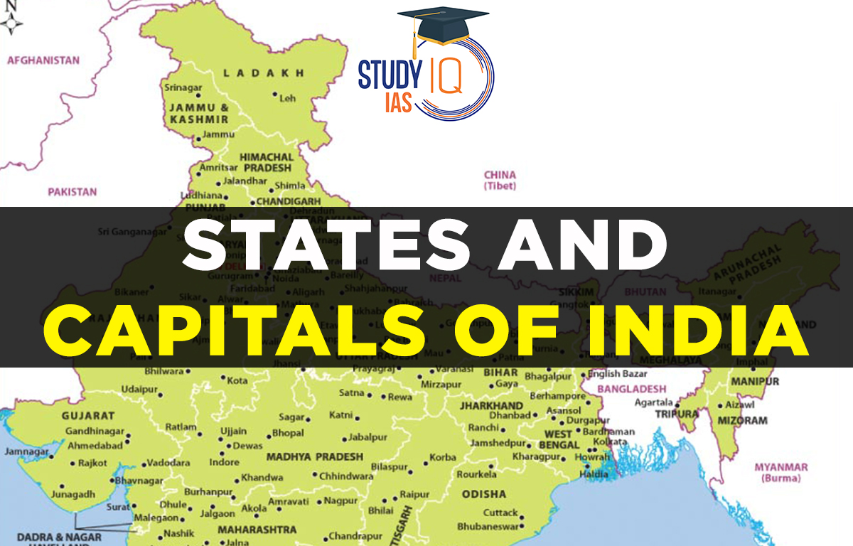
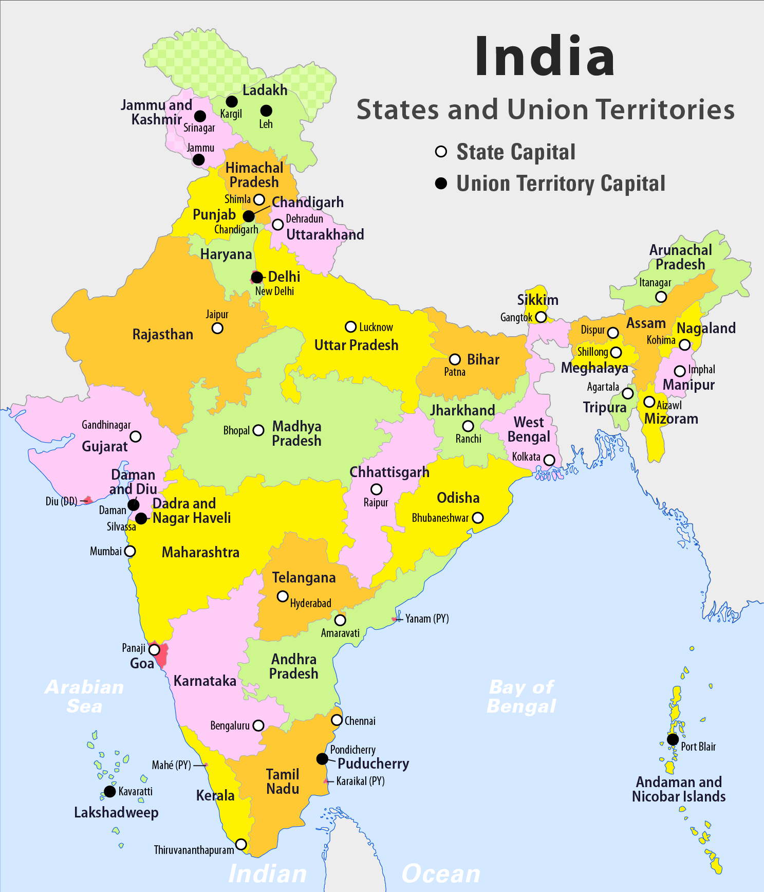
India Map with States and their Capitals
Here is an India Map with States and their capital for a better understanding of territories’ location, neighbouring states and many more.
| Quick Facts |
|
List of 8 Union Territories of India and their Capitals
India has had 8 union territories since 26th January 2024, by merging Daman and Diu with Dadra and Nagar Haveli into a single union territory. Here we have discussed the Union Territories of India in the table below:
| No. | Union Territory | Capital |
|---|---|---|
| 1 | Andaman and Nicobar Islands | Port Blair |
| 2 | Chandigarh | Chandigarh |
| 3 | Dadra and Nagar Haveli and Daman and Diu | Daman |
| 4 | Delhi (NCT) | New Delhi |
| 5 | Jammu and Kashmir | Srinagar (Summer), Jammu (Winter) |
| 6 | Ladakh | Leh |
| 7 | Lakshadweep | Kavaratti |
| 8 | Puducherry | Puducherry |
Indian States and their Capitals: History
India is a republic with a parliamentary form of government that is a sovereign, secular, democratic nation. Both its natural beauty and cultural heritage are plentiful in this country. The linguistic, cultural, and geographic division of India is based on its States and capitals. After becoming independent, it was divided into the British Provinces and the Princely States. The princely states had three alternatives once India and Pakistan were divided:
- Remaining independent
- Joining Pakistan
- Joining India
Out of the 552 princely states that made up India, 549 became part of it, and the other 3 refused. They did, however, eventually integrate. The Indian Constitution was ratified on November 26, 1949, and it went into effect on January 26, 1950. The States Reorganisation Act of 1956 altered the state boundaries of India based on linguistic distinctions.
India is one of the oldest civilisations in the world, known for its diverse culture and rich history. Since gaining independence, India has made significant progress in many areas. As the seventh-largest country globally, it is unique in Asia, surrounded by mountains and oceans that give it a special geographical identity. The Great Himalayas are in the north, and as you move south, India narrows down into the Indian Ocean, with the Bay of Bengal on the east and the Arabian Sea on the west.
- Article 1 of the Indian Constitution declares India to be a Union of States.
- The official name of India is Bharat, combining traditional and modern names.
- India’s territory includes states, union territories, and any future acquired territories.
- Parliament can create new states or admit them into the Union under its own terms.
28 States and Capitals of India
Currently, India has a total of 28 States and 8 Union Territories. Three states, Himachal Pradesh, Maharashtra, and Uttarakhand, have separate capitals for their summer and winter legislative sessions.
According to the Preamble of Indian Constitution, India is a republican, socialist, secular, and independent state. A democratic parliamentary system is used in India. The Indian President is in charge of the Union Territories. The President and the Governors serve as the executive branches of their respective states. State governments resemble the federal government in many ways. Chief Ministers oversee the state governments.
New Developments
- 2019: The Jammu and Kashmir Reorganisation Act was enacted, creating two Union Territories: Jammu & Kashmir and Ladakh, making it the first time a state was split into two Union Territories. Since January 26, 2020, India has 8 Union Territories and 28 states.
- 2020: On January 26, Daman and Diu merged with Dadra and Nagar Haveli to become one Union Territory.
- Some states, like Himachal Pradesh, Maharashtra, and Uttarakhand, have different capitals for their summer and winter legislative sessions.
- Ladakh also has two administrative capitals: Leh and Kargil.
Details About State Formation in India
The States Reorganisation Act of 1956 was important in changing the borders of Indian states. It combined three types of states, Part A, Part B, and Part C, into one type of state according to a change in the Indian Constitution.
- Part A included areas that were formerly British India’s governor regions.
- Part B included former royal states.
- Part C included certain princely states and regions governed by chief commissioners.
Even though many state boundaries have changed since 1947, this Act is still seen as a key factor in shaping the current structure of Indian states.
Difference between States and Union Territories
| Particulars | State | Union Territories |
| Administrative Units | Own administrative units with the elected government | Controlled and administered by the Central Government |
| Executive Head | Governor | President |
| Relationship with Centre | Federal | Unitary with the Centre (all powers rest with the Union) |
| Administration | Chief Minister, elected by the people | Administrator appointed by the President (except Delhi, Puducherry, and Jammu & Kashmir) |
| Head | The Chief Minister is the real head | The lieutenant is the real head |
States and Capitals of India UPSC
Andhra Pradesh was the first state in India to be created based on a language. It originated from Madras State’s northern Telugu-speaking districts. According to the 1956 States Reorganization Act, new states were created, or existing states were reorganized along linguistic grounds. Students can read all the details related to UPSC by visiting the official website of StudyIQ UPSC Online Coaching.
 List of Chief Ministers of Bihar (1947 t...
 World Autism Awareness Day 2026, Theme, ...
 Mahavir Jayanti 2026: Date, History, Sig...