The NAKSHA Programme is a pioneering initiative by the Government of India aimed at modernizing urban land records through advanced geospatial technology. Launched on February 18, 2025, by Union Minister Shri Shivraj Singh Chouhan in Raisen, Madhya Pradesh, the pilot project encompasses 152 Urban Local Bodies (ULBs) across 26 states and 3 Union Territories
NAKSHA Programme
- NAKSHA stands for National Geospatial Knowledge-based Land Survey of Urban Habitations.
- It aims to create and update land records in urban areas to ensure accurate and reliable documentation of land ownership.
Objectives of NAKSHA
- Accurate and reliable land records: Updating land records in urban and semi-urban areas.
- Empowering citizens: Reducing land disputes and improving ease of property transactions.
- Enhancing urban planning: Supporting infrastructure projects and smart city initiatives.
- Ensuring transparency & efficiency: IT-based system for property record administration.
- Sustainable development: Facilitating orderly urban growth and minimizing conflicts over land ownership.
Implementation Strategy
- Aerial Surveys: The Survey of India, serving as the technical partner, conducts aerial surveys and supplies orthorectified imagery through third-party vendors to state and Union Territory governments.
- Web-GIS Platform Development: The Madhya Pradesh State Electronic Development Corporation (MPSEDC) is responsible for creating an end-to-end web-based Geographic Information System (GIS) platform to manage and analyze geospatial data effectively.
- Data Storage Solutions: The National Informatics Centre Services Inc. (NICSI) provides secure storage facilities to maintain the integrity and accessibility of the collected data.
- Field Surveys and Validation: State and Union Territory governments conduct field surveys and ground truthing using orthorectified imagery, leading to the final publication of urban and semi-urban land records.
 Accredited Social Health Activists (ASHA...
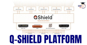 World’s 1st Unique Q-Shield Platform a...
 New Phase of Operation Chakra to Combat ...