Table of Contents
Important Boundary Lines in the World
There are numerous Important Boundary Lines in the World, some of which have historical, political, and social significance. The geographical borders of political or legal jurisdictions such as countries, customs territories, and sovereign states are referred to as international boundaries. The process of establishing a border is known as boundary delimitation. Some international borders, such as those within a free movement zone such as the European Union, are either poorly guarded or completely open. Others, such as the India-Pakistan border or the North Korea-South Korea border, may be heavily patrolled, with access limited to designated crossings.
There are many Important Boundary Lines in the World that a UPSC aspirant should know about. Important Boundary Lines in the World is an important topic in the UPSC Geography Syllabus.
List of Important Boundary Lines in the World
These are just a few of the many important international borders around the world, each with its own unique history and significance. The following table lists the Important Boundary Lines in the World for government Exam:
| Name of Lines/Boundaries | Between | Features/ Description |
| 17th Parallel | South Vietnam & North Vietnam | North and South Vietnam were once separated by the 17th latitude from the equator. |
| It was drawn in accordance with the Geneva Accords of 1954. | ||
| After Vietnam’s unification in 1976, the 17th parallel became obsolete. | ||
| 20th Parallel | Libya & Sudan | It is situated on the 20th northern latitude and serves as the border between Sudan and Libya. |
| 22nd Parallel | Egypt & Sudan | The Sudan-Egypt border is marked by the 22nd latitude north of the equator. |
| 25th Parallel | Mauritania & Mali | This line denotes the northernmost section of the Mali-Mauritania border. |
| 31st Parallel | Iran & Iraq | The border between Iraq and Iran is marked by the 31st northern latitude. |
| It also serves as the dividing line between the US states of Louisiana and Mississippi. | ||
| 38th Parallel | South Korea & North Korea | The 38th parallel divides the central part of the Demilitarized Zone between North and South Korea. |
| 49th Parallel | The USA & Canada | It’s 49 degrees north of the equator. |
| It forms the international border between the northern United States (excluding Alaska) and Canada and was established following the Anglo-American Convention of 1818 and the Oregon Treaty of 1846. | ||
| Durand Line | Pakistan & Afghanistan | Sir Mortimer Durand delimited Afghanistan with the agreement of the former Amir of Afghanistan in 1893. |
| The Durand line is not recognised by modern-day Afghanistan. | ||
| Hindenburg Line | Poland & Germany | During World War I, it was a German defensive line in French territory. |
| The Treaty of Versailles in 1919 rendered it obsolete. | ||
| McMahon Line | China & India | Sir Henry McMahon created it in 1914 after consulting with Tibetan representatives. |
| Although China disputes the legality of this line, it serves as the de facto border between India and China. | ||
| Maginot Line | Germany & France | Before World War II, it was a defensive line along the French border with Germany. Following Germany’s successful invasion of France following the outbreak of World War II, the Maginot line was rendered obsolete. |
| Mannerheim Line | Russia & Finland | During World War II, Finland built this as a defensive line against the Soviet Union during the Winter War. |
| Oder-Neisse Line | Poland & Germany | It follows the Oder and Lusatian Neisse rivers. |
| According to the Potsdam Conference, it demarcates the Polish-German border. In 1990, a unified Germany recognised it. | ||
| Radcliffe Line | India & Pakistan | Sir Cyril Radcliffe demarcated it for the partition of India and the formation of East and West Pakistan. |
| It comprises modern-day India, Bangladesh, and Pakistan. | ||
| Siegfried Line | France & Germany | The Weimar Republic and, later, the Third Reich of Germany built it as an extension of the Hindenburg defensive line on the western front of World War I. |
| Blue Line | Lebanon & Israel | The United Nations published a border demarcation between Lebanon and Israel on June 7, 2000, to determine whether Israel had fully withdrawn from Lebanon. |
| Attila Line / Green Line / UN Buffer Zone | The Republic of Cyprus & Turkish Cyprus | A demilitarized zone patrolled by the United Nations Peacekeeping Force in Cyprus (UNFICYP), established in 1964 and extended in 1974 following the 16 August 1974 ceasefire. |
Important International Boundary Lines Name
A large number of notable international boundary Lines in the world, each with its own significance and history. These are just a few of the world’s many important international borders, each with its own distinct history and significance.
1. The border between the United States and Mexico: The border between the United States and Mexico is one of the busiest in the world, serving as a vital gateway for trade and migration.
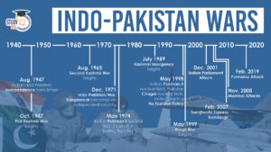
2. The India-Pakistan Border: The India-Pakistan border is heavily militarised and has been the site of several conflicts, including the Indo-Pakistani Wars of 1947, 1965, and 1971.
3. North Korea – South Korea Border: The Demilitarized Zone (DMZ) between North Korea and South Korea is one of the world’s most heavily fortified borders and a symbol of the two countries ongoing tensions.
4. The border between China and India: The border between China and India is disputed in several areas, which has resulted in several border conflicts between the two countries.
5. The border between Canada and the United States: The border between Canada and the United States is the world’s longest international border, and it serves as an important trade route and cultural exchange between the two countries.
6. The border between Germany and Poland: The border between Germany and Poland has a complicated history and has been the site of many conflicts throughout the twentieth century, including World War II.
7. The border between Israel and Palestine: The border between Israel and Palestine is highly contested and a major source of conflict in the region.
9. The border between Spain and Morocco: The border between Spain and Morocco is an important gateway for migration from Africa to Europe, and it has been a source of contention due to a large number of refugees and migrants attempting to cross.
10. The Arctic Circle: This boundary marks the planet’s northernmost point and is critical for understanding climate change and international relations between Arctic countries.
11. English Channel: This body of water separates England from France and serves as an important trade, tourism, and migration border.
12. Panama Canal: The Panama Canal is an important maritime trade border because it connects the Atlantic and Pacific Oceans.
13. The Rio Grande: This river serves as a natural border between the United States and Mexico, and it is a vital source of water for both countries.


 List of Indo-Pakistan Wars and Conflicts...
 Daily Quiz 24 April 2025
 United States Federal Reserve (US Fed)


