Table of Contents
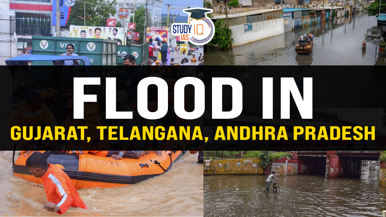
Context: Andhra Pradesh and Telangana experienced heavy rainfall which led to severe flooding and widespread waterlogging across both states.
What is Flood?
- A flood is a state of high water level along a river channel or on the coast that leads to inundation of land.
- Floods are commonly associated with a stream or river. A stream floods when its discharge is greater than the capacity of its river channel.
- Excess water flows over the river banks and submerges the adjacent land which is usually dry. When it happens, the channel and the flood plain together allow the passage of water.
Causes of Floods
Natural Causes
- Heavy rainfall: Heavy rain in the catchment area of a river causes water to overflow its banks, which results in the flooding of nearby areas.
- Example: In July 2023, Delhi received heavy rainfall which contributed to the flooding of large parts of the city.
- Snow melt: Snowmelt and glacial melt are gradual processes and usually does not cause major floods. But sometimes glaciers hold large quantities of bounded water, which may be suddenly released with the melting of ice blocks resulting into Glacial Lake Outburst Floods (GLOFs).
- In October 2023, flash floods in Sikkim that wiped out settlements and decimated lives are attributed to a GLOF.
- Sediment deposition: River beds become shallow due to sedimentation. The water-carrying capacity of such rivers is reduced. As a result, the heavy rainwater overflow the river banks.
- Frequent floods were observed in 2003, 2008, 2011, and 2013 near the deltaic region of the Mahanadi river due to the excessive sediment deposition.
- Tropical cyclones and hurricanes: These powerful weather systems often bring heavy rainfall and storm surges, resulting in widespread flooding in coastal and low-lying areas.
- Recently, Cyclone Asna contributed to heavy rainfall and flood situations along coastal areas of Gujarat.
- Change in the course of the river: Meanders, erosion of river beds and banks, and obstruction of flow due to landslides also lead to changes in river courses.
- The 2008 Kosi River flood resulted from heavy rainfall and a subsequent course change, leading to catastrophic flooding, displacement of thousands, and widespread damage in Bihar, India.
- Tsunami: Large coastal areas are flooded by rising sea water, when a tsunami strikes the coast.
- Lack of Lakes: Lakes can store the excess water and regulate the flow of water. When lakes become smaller, their ability to regulate the flow become less and hence flooding.
Anthropogenic causes
- Deforestation: The removal of trees and vegetation reduces the natural absorption of rainfall, leading to increased surface runoff and a higher likelihood of flooding.
- The devastating floods that hit the state of Kerala in 2018 were partially attributed to deforestation, as the loss of forest cover reduced the natural water-holding capacity of the region.
- Urbanisation: Construction of buildings, roads, and other infrastructure reduces natural permeable surfaces, which can exacerbate surface runoff and overwhelm drainage systems.
- Chennai experienced severe flooding in 2015 due to heavy rainfall combined with unplanned urbanisation. The city’s drainage systems were overwhelmed, resulting in widespread inundation and disruption.
- Land use changes: Alterations in land use, such as converting natural wetlands into agricultural or urban areas, can disrupt natural water retention and drainage patterns, increasing the risk of flooding.
- Dam failures: Structural failures or breaches in dams and reservoirs can release large volumes of water downstream, causing severe flooding.
- In 2019, the collapse of the Tiware Dam in Maharashtra caused flash floods in downstream villages.
- Interference in drainage system: Drainage congestion caused by badly planned construction of bridges, roads, railway tracks, canals etc. hampers the flow of water and results in floods.
Distribution of Flood Prone Areas in India
| The Brahmaputra River Region |
|
| The Ganga River Region |
|
| The North-West River Region |
|
| The Central and Deccan India |
|
Consequences of Floods
- Loss of life and injuries: Floods can result in the loss of human lives and cause injuries, especially when people are caught unaware or unable to evacuate in time.
- Damage to infrastructure: Floodwaters can cause severe damage to roads, bridges, buildings, and other infrastructure. This damage can disrupt transportation networks, communication systems, and essential services, making rescue and relief operations challenging.
- Displacement and homelessness: Floods often force people to evacuate their homes and seek shelter in temporary accommodations or relief camps.
- Impact on agriculture and food security: Floods can devastate agricultural lands and crops, destroy livestock leading to significant losses in the agricultural sector.
- Water contamination and health risks: Spread of diseases like cholera, gastro-enteritis, hepatitis and other water-borne diseases spread in the flood-affected areas.
- Environmental damage: Floods can cause erosion, sedimentation, and the destruction of natural habitats.
- Soil fertility: Floods also make a few positive contributions. Every year, flood deposit fertile silt over agricultural fields which restores fertility of the soil.
Need for Flood Management
- During the monsoon season, approximately 350,000 million gallons of water flow into the Yamuna daily. Preserving this water could supply Delhi residents with drinking water for a year.
- In November 2022, the floodwater released into the sea in Chennai could have met the city’s water needs for half a year.
- Floodwater can be conserved to address drought and water scarcity during the summer months.
- Per capita water availability in India has sharply declined from 5,177 cubic metres per year in 1951 to 1,486 cubic metres in 2022, with a further projected decline to 1,367 cubic metres by 2031.
- The Union Ministry of Housing and Urban Affairs reports that per capita water consumption is 135 litres in urban areas and 55 litres in rural areas.
- Two-thirds of India’s 718 districts face significant water scarcity issues.
- Growing awareness of safe drinking water has led to a rise in spending on bottled/packaged water, with 12.2% of urban households relying on it in 2018, up from 2.7% a decade earlier. In rural areas, consumption increased from 0.5% in 2008 to 4% in 2018.
- Empirical evidence underscores the necessity of managing rainfall productively to combat water scarcity.
Flood Prevention and Mitigation
Structural Measures
- Dams and Reservoirs: Construction of dams and reservoirs to store excess water during heavy rainfall and release it in a controlled manner, reducing downstream flood risk.
- Levees and Floodwalls: Building embankments, levees, and floodwalls along rivers and coastlines to contain floodwaters and protect adjacent areas from inundation.
- Flood Diversion Channels: Creation of diversion channels or canals to redirect excess water away from vulnerable areas, reducing flood impact.
- Flood Control Basins: Designing flood control basins or detention ponds to temporarily store and regulate floodwaters, preventing their rapid downstream flow.
- Channelization: Modifying and straightening river channels to improve their flow capacity and efficiency, reducing the risk of overflow and flooding.
- Floodplain Restoration: Restoring natural floodplains by removing obstructions, reconnecting floodplain habitats, and creating additional space for water storage during floods.
Non-Structural Measures
- Floodplain Zoning and Land Use Planning: Implementing zoning regulations that restrict construction in high-risk floodplain areas, ensuring that development is appropriately located and mitigating potential flood damage.
- Early Warning Systems: Establishing robust early warning systems that use technology and community engagement to provide timely alerts and evacuation guidance to vulnerable populations.
- Flood Insurance and Financial Mechanisms: Promoting the availability of flood insurance to incentivize risk reduction measures and provide financial protection to individuals and businesses affected by floods.
- Public Awareness and Education: Conducting public awareness campaigns to educate communities about flood risks, safety measures, and preparedness strategies, fostering a culture of resilience.
- Urban Drainage Systems: Developing and maintaining efficient stormwater drainage systems in urban areas to manage excess rainfall and prevent waterlogging and urban flooding.
- Ecosystem-Based Approaches: Preserving and restoring natural ecosystems, such as wetlands and mangroves, which act as natural buffers and absorb floodwaters, reducing flood impacts.
- Integrated Water Resources Management: Adopting an integrated approach to water resources management that considers the entire watershed, balancing water allocation, flood control, and environmental sustainability
 Grasslands in the World, Map, Types and ...
 Places in News for UPSC 2025 for Prelims...
 Earthquake in Delhi: Causes, Impacts and...