Table of Contents
About the Cyclone Mandous
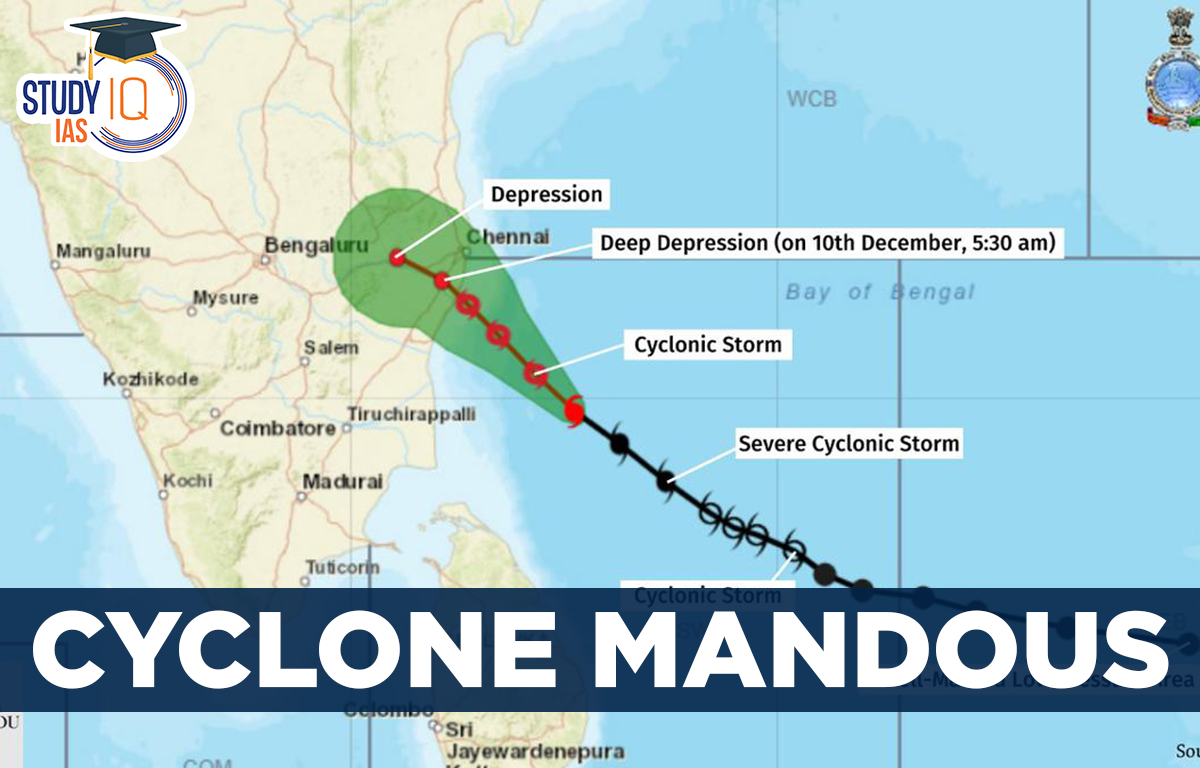
Mandous is a slow-moving tropical cyclone that often absorbs a lot of moisture, carries a humongous amount of rainfall and gains strength in the form of wind speeds. Named by: The name ‘Mandous’ for the cyclone has been suggested by the United Arab Emirates. It means “treasure box” in Arabic. Origin and Path: It has originated in the Bay of Bengal and is expected to move northwestwards and cross north Tamil Nadu, Puducherry and adjoining south Andhra Pradesh coasts between Puducherry and Sriharikota around Mamallapuram (Mahabalipuram).Impact: IMD reported that the cyclone will cause heavy to very heavy rainfall across parts of Tamil Nadu.
What are Cyclones?
Cyclones are rapid inward air circulation around a low-pressure area whereas anti-cyclones are circulation of winds around a high-pressure area.
| Pressure system | Pressure condition at the centre | Pattern of wind direction | |
| Northern Hemisphere | Southern Hemisphere | ||
| Cyclone | Low | Anticlockwise | Clockwise |
| Anti-cyclone | High | Clockwise | Anticlockwise |
- Types:There are two types of cyclones.
- Tropical cyclones (also called typhoon or hurricane, an intense circular storm that originates over warm tropical oceans).
- Extra Tropical cyclones (also called temperate cyclones or middle latitude cyclones or Frontal cyclones or Wave Cyclones).
Tropical Cyclones
- A tropical cyclone is a warm-core, low pressure system without any “front” attached, that develops over the tropical or subtropical waters, and has an organized circulation.
- Tropical cyclones develop in the region between the Tropics of Capricorn and Cancer.
- Cyclone season in India: Typically, tropical cyclones in the North Indian Ocean region (Bay of Bengal and Arabian Sea) develop during the pre-monsoon (April to June) and post monsoon (October to December) periods.
- Why generally cyclones do not form during active monsoon season?
- Vertical wind shear: During the monsoon season, there exists very high vertical wind shear due to strong monsoon currents. This dampens the intensification in strength and wind speeds of cyclone. As a result, clouds do not grow vertically and monsoon depressions often fail to intensify into cyclones.
- Strong opposing winds: Generally, the monsoon conditions are not favourable for cyclones to develop in the North Indian Ocean due to the presence of strong opposing winds i.e. “the lower atmospheric winds are in one direction (southwesterly) and the upper atmospheric winds are in the other direction (northeasterly). This prevents a cyclone from developing vertically.”
How are Cyclones Named?
- Cyclones that form in every ocean basin across the world are named by the regional specialised meteorological centres (RSMCs)and Tropical Cyclone Warning Centres (TCWCs).
- There are six RSMCs in the world, including the India Meteorological Department (IMD), and five TCWCs.
- In 2000, a group of nations called WMO/ESCAP (World Meteorological Organization/United Nations Economic and Social Commission for Asia and the Pacific), which comprised Bangladesh, India, the Maldives, Myanmar, Oman, Pakistan, Sri Lanka and Thailand, decided to start naming cyclones in the region.
- After each country sent in suggestions, the WMO/ESCAP Panel on Tropical Cyclones (PTC) finalized the list.
- The WMO/ESCAP expanded to include five more countries in 2018 — Iran, Qatar, Saudi Arabia, United Arab Emirates and Yemen.
- The list of 169 cyclone names released by IMD in April 2020 were provided by these countries — 13 suggestions from each of the 13 countries.
Why is it Important to Name Cyclones?
- Adopting names for cyclones makes it easier for people to remember.
- With a name, it is also easy to identify individual cyclones, create awareness of its development, rapidly disseminate warnings to increase community preparedness and remove confusion where there are multiple cyclonic systems over a region.


 Supreme Court Upholds the Right to Die w...
 GDP Growth vs Employment Reality: Unders...
 Bill to Codify IPS Deputation in CAPFs: ...


