Table of Contents
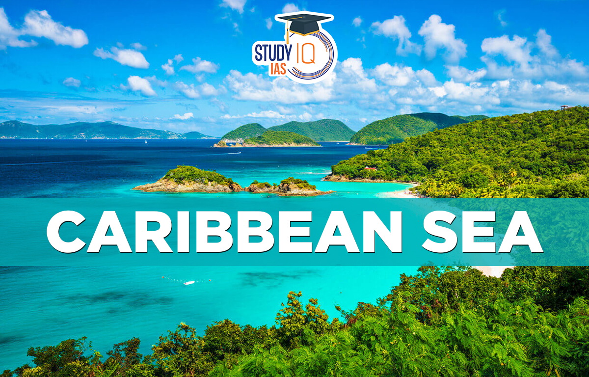
Caribbean Sea
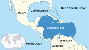
The Caribbean Sea is a large area of water in the western Atlantic Ocean, located between latitudes 9° and 22° N and longitudes 89° and 60° W. It covers about 2,753,000 square kilometers. To the south, it is bordered by
- Venezuela,
- Colombia, and
- Panama.
To the west, it touches Costa Rica, Nicaragua, Honduras, Guatemala, Belize, and the Yucatan Peninsula in Mexico. The north is lined by islands like Cuba, Hispaniola, Jamaica, and Puerto Rico, while the Lesser Antilles form the eastern boundary. Jamaica, south of Cuba, is the largest island in the Caribbean. The Caribbean Sea and the Gulf of Mexico are sometimes called the American Mediterranean because they are between two landmasses, but they are very different in water and climate. The deepest part of the Caribbean is the Cayman Trench, which reaches about 7686 meters below sea level.
Read about: Indian Ocean
Caribbean Sea on World Map
The Caribbean Sea, located southeast of the Gulf of Mexico and part of the Atlantic Ocean, is a tropical sea in the Western Hemisphere.
Read More: South China Sea
Caribbean Sea Islands/Boundaries
The Caribbean sea is bordered by the following countries:
- South: Venezuela, Colombia, and Panama;
- West: Central America (Costa Rica, Nicaragua, Guatemala, Honduras, and Belize);
- North: the Greater Antilles (Cuba, Jamaica, Dominica, and Puerto Rico);
- East: the Lesser Antilles. (In the eastern Caribbean Sea, Anguilla is a British overseas territory.)
Read More: East China Sea
Caribbean Sea Significance
The Caribbean Sea is significant for several reasons:
- Strategic Location: The Caribbean Sea provides access to the Atlantic Ocean and the Gulf of Mexico, making it an important shipping route for goods and people.
- Tourism: The Caribbean is famous for its tropical climate, clear waters, and white sand beaches, making it a popular tourist destination.
- Natural Resources: The Caribbean Sea is rich in natural resources such as oil, gas, and minerals, which provide valuable economic benefits to the region.
- Biodiversity: The Caribbean Sea is home to a diverse range of plant and animal species, including many that are found nowhere else on Earth.
- Culture: The Caribbean is also significant for its unique blend of African, indigenous, and European cultures, which has produced a rich cultural heritage in the region.
Read More: Ocean Waves
Caribbean Sea Climatology
The Caribbean has a mostly tropical climate, but it can vary a lot due to things like mountains, ocean currents, and trade winds. Rainfall differs widely for example, Bonaire gets about 25 cm of rain a year, while some areas in Dominica get around 900 cm annually. The northeast trade winds are common in the region, blowing at an average speed of 16 to 32 km per hour.
- The Caribbean is at risk from hurricanes, which can harm coastal communities and economies.
- The region’s climate is influenced by low latitude and tropical ocean currents, with the North Equatorial Current being the main current.
- The climate varies from tropical rainforest to tropical savanna, with some areas experiencing dry climates and occasional droughts.
- Lowland regions like Costa Rica, Belize, the Dominican Republic, and Puerto Rico have tropical rainforest climates, while parts of Cuba and northern Venezuela have drier savanna climates.
- Tropical cyclones often form off the West Coast of Africa and travel west to the Caribbean, mainly affecting the region between August and September during hurricane season, which runs from June to November.
Read More: Climatology
Caribbean Sea UPSC
The Caribbean Sea is referred to as a Marginal sea and a Mediterranean sea, respectively. Along with the Dead Sea, the Caspian Sea is also referred to as a marginal sea. Marginal seas are oceanic extensions that are partially encircled by land. The North Sea, Arabian Sea, Red Sea, and Bering Sea are a few examples of marginal seas. Black Sea, Caspian Sea, Aral Sea, and Dead Sea are a few instances of inland oceans that are totally encircled by land.
Read More: Ocean Deposits
 Union Territories of India with Capital,...
 Bihar Caste Census Report 2023, Caste Wi...
 Bahmani Kingdom (1347-1527 AD), History,...